~Seventeen Articles That Will Reshape Property Registration, Construction, Navigation, and Government Authority across St. Maarten.~
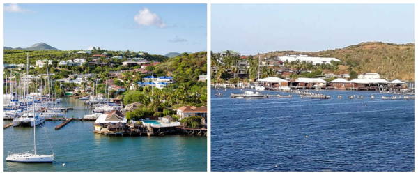 PHILIPSBURG/MARIGOT:--- The historic border agreement between France and the Kingdom of the Netherlands does much more than transform an old line on a map into hundreds of satellite-based coordinates.
Its 17 articles create new legal obligations affecting property registration, construction near the frontier, access across private land, navigation in Oyster Pond and Simpson Bay Lagoon, maintenance of border markers, and the future handling of disputes between the two governments.
The treaty also creates a permanent joint commission with authority to supervise the boundary and propose adjustments to its coordinates.
For property owners, developers and businesses situated near the frontier, the consequences are particularly important. New construction will generally be prohibited within two metres on either side of the border. Certain properties may have to be removed from one country’s land register and entered into the others. Existing activities may continue, but under the laws of the territory in which the treaty places them.
The agreement therefore does not simply answer the question, “Where is the border?”
It determines what happens when the newly defined border affects buildings, ownership records, businesses, access roads, fishing, marinas and government jurisdiction.
France has completed its principal parliamentary approval process. The agreement will not enter into force, however, until the Kingdom of the Netherlands completes its procedures and both parties exchange the required diplomatic notifications. The French government formally introduced its approval bill on February 25, 2026, under an accelerated procedure after the agreement had been signed at Belle Plaine/Belvédère on May 26, 2023.
A border measured through more than 400 points
The agreement defines the frontier from Point D, at the eastern end of the island, to Point C, at its western end. Those two points connect the new land and internal-water boundary to the maritime delimitation already agreed between France and the Kingdom in 2016.
Between those endpoints, the treaty identifies:
- 15 points in the Oyster Pond area;
- 392 land-boundary points;
- the connection from Point D to the first Oyster Pond point;
- and the connection from the final land point to Point C.
Successive points are joined by straight geodetic lines. The Oyster Pond and maritime coordinates are tied to internationally recognized geodetic reference systems, while the land points are expressed through the International Terrestrial Reference System.
The precision is extraordinary. Annex A occupies much of the official publication, listing the latitude and longitude of each point individually. Annex B adds three points defining the legal closing line across the entrance to Oyster Pond. Annex C provides an illustrative map, while Annex D incorporates the historic Werbata map as an official reference.
The French Senate described the agreement as ending an old and damaging legal uncertainty, restoring effective sovereignty, securing economic activities and strengthening cooperation between the two sides of the island.
But those objectives are achieved through provisions that deserve far more public examination than they have so far received.
Article 1: The definitions that control the agreement
Article 1 defines three central concepts.
The first is “internal waters,” meaning waters situated on the landward side of the baseline from which the territorial sea is measured.
That definition matters because Article 4 places Oyster Pond in this category. It means Oyster Pond is not treated merely as open territorial sea. It is legally enclosed as internal water divided between two sovereign jurisdictions.
The second definition concerns the Werbata map, published in 1915 by J. Smulders & Co. using the topographical work of engineers Werbata and Jonckheer.
This century-old map is not included simply for historical decoration. It may be consulted by the future Mixed Commission when considering whether the numerical coordinates in Annex A require adjustment.
The third definition identifies the 2016 Maritime Delimitation Treaty, which already established the sea boundaries surrounding the island. The 2023 agreement completes the missing connection across Oyster Pond and the island’s landmass.
Article 2: One Continuous International Frontier
Article 2 states the agreement’s objective plainly: to delimit the boundary from the eastern endpoint, Point D, to the western endpoint, Point C.
This is significant because it ties together three components:
- the eastern maritime boundary;
- the border through Oyster Pond and across the island;
- the western maritime boundary.
Once the treaty takes effect, France and the Kingdom will have one legally continuous frontier extending from the waters east of Oyster Pond, across the entire island, and into the sea west of the Lowlands and Terres Basses.
The agreement therefore completes the framework begun by the 2016 maritime treaty.
Article 3: The Coordinates Become the Border
Article 3 is the treaty’s technical core.
It declares that the course of the boundary is established by the numerical geographical coordinates contained in Annex A. A straight geodetic line connects each consecutive point.
This provision means that the legally controlling frontier will no longer depend solely on memory, custom, old walls, roads, ridgelines or general assumptions. Those physical features may still mark the border, but the coordinates provide the legal foundation.
The treaty uses modern international reference systems to ensure that surveyors from both jurisdictions can reproduce the same line.
Yet Article 3 also leaves room for later correction.
The Mixed Commission may propose adjustments to the numerical coordinates after considering:
- the Werbata map for the land boundary;
- or the principle of equidistance in Oyster Pond.
The governments may then approve those adjustments by mutual agreement through the procedure established under Article 16.
This does not give the Commission unilateral power to transfer territory. It may propose technical changes, but both parties must approve them.
The wording nonetheless makes clear that the present list of hundreds of coordinates is not necessarily immune from correction if future fieldwork reveals inconsistencies between the numerical line, the historic map and the agreed boundary principles.
Article 4: Oyster Pond Becomes Internal Water
Article 4 formally designates the waters of Oyster Pond as internal waters.
That is one of the agreement’s most consequential legal decisions.
Ordinarily, a coastal state exercises a particularly strong form of sovereignty over internal waters. However, the treaty immediately places an important limitation on that principle by recognizing and guaranteeing innocent passage for all vessels, regardless of nationality.
The pond will therefore fall within the internal waters of the respective jurisdictions through which the boundary passes, while remaining navigable under the treaty’s guaranteed passage rights.
The legal entrance to Oyster Pond is established by a straight geodetic closing line containing:
- a Dutch base point;
- a median point, which is also Point Z01;
- and a French base point.
The line does not represent the entire international boundary through the pond. It defines the mouth or legal closing line from which the waters landward are treated as internal waters. From the middle point, the international border continues through Oyster Pond using the 15 points listed in Annex A.
Article 5: Navigation and Fishing Rights in two Lagoons
Article 5 applies to both Oyster Pond and Simpson Bay Lagoon.
Subject to the laws operating in each territory, France and the Kingdom mutually recognize and guarantee certain rights for vessels flying their respective flags:
- access;
- freedom of navigation;
- anchoring;
- and traditional fishing.
These rights are important because both water bodies interact with the international boundary.
The guarantee does not mean that vessels are exempt from safety, immigration, customs, environmental or maritime regulations. Article 5 expressly subjects the rights to the laws and regulations applicable in the relevant territory.
The provision also excludes warships and non-commercial government vessels from this arrangement. Cooperation involving those vessels must be handled under separate agreements or mechanisms.
For fishermen, boat owners and marina operators, this article may be more immediately relevant than the hundreds of coordinates. It preserves established access and use while confirming that each side retains regulatory authority within its territory.
Article 6: The Border Must Remain Visible
Article 6 requires the boundary to be marked and maintained so that its course is clear and can be followed along its entire length.
The treaty recognizes that the existing frontier may already be represented by physical features such as:
- walls and low walls;
- monuments;
- rivers;
- roads;
- and ridgelines.
The Mixed Commission will later describe and catalogue those features. It may also establish new markers, alter existing ones or remove markers that it considers unsuitable.
Each government must protect and maintain the markers on its side and prevent their destruction, deterioration or improper use.
One of the article’s most striking provisions allows the Commission, when necessary, to keep a strip of land up to four meters wide permanently free of vegetation—two meters on each side of the boundary.
This is not authority to create a four-meter road or security zone across the island. The provision is specifically intended to allow access, inspection and maintenance of the frontier. Nevertheless, it could directly affect privately held land situated on the line.
The cost of demarcation and maintenance will ordinarily be divided equally between France and the Kingdom. When new border work becomes necessary because of a concession project, however, the concession holder must pay the related cost.
Equipment and materials needed for border maintenance may temporarily enter the other jurisdiction without ordinary obstacles, provided unused materials, equipment and vehicles return to the territory from which they came after the work is completed.
Private owners may be required to maintain border structures
Article 6 also imposes duties on private and corporate owners.
Where a privately owned wall, monument or other structure is retained as an official border marker, its owner remains responsible for maintaining it.
Owners must:
- keep or restore the structure in proper condition;
- comply with technical instructions from the Mixed Commission;
- provide officials with continuing access;
- clear surrounding land when required;
- and attend or be represented during inspections when requested.
If an owner fails to comply, the relevant government may carry out the work and seek reimbursement.
New markers placed directly on the border axis will be jointly owned by the two governments. Other new markers will belong to the government on whose territory they are installed.
This provision means that an ordinary private wall could acquire international importance if the Commission formally recognises it as a boundary marker.
Article 7: Official Access May Cross Private Roads
Article 7 guarantees free access to roads, streets and paths running along the border.
It also grants access rights to officials carrying out services in the public interest when they need to reach the boundary through a private road.
This is not a general right for members of the public to enter private property. It is a specific operational right for authorised officials responsible for border-related public duties.
Property owners along the frontier must therefore understand that the treaty may create official access obligations where no practical public route exists.
Article 8: No New Buildings within two Meters
Article 8 could become the provision with the greatest effect on planning and construction.
It states that no new structure may be erected within two meters on either side of the boundary.
Where a river or road forms the frontier, the distance is measured from the relevant banks, verges or edges.
The two sides may jointly approve exceptions through the Mixed Commission to accommodate special existing situations, but only where the building will not interfere with access, maintenance or surveillance of the boundary.
The restriction does not apply to structures belonging to official services or to approved public works.
Existing structures legally built under the applicable laws are tolerated as acquired rights. However, when such a structure is demolished or materially altered, any reconstruction or modification must comply with the new two-meter rule and the domestic planning laws of the relevant territory.
The same requirement applies to ruined or dilapidated buildings.
This means an old structure standing close to the boundary may remain, but its owner may not automatically have the right to rebuild it in exactly the same position after demolition.
That issue could become particularly important in developed areas where homes, walls, commercial buildings or access structures already sit near the accepted frontier.
Article 9: A Permanent Six-Member Border Commission
Article 9 creates the Mixed Commission for the Supervision and Maintenance of the Boundary when the treaty enters into force.
The treaty says the Commission consists of three representatives of the parties. In context, this means each side forms a delegation and may appoint any experts it considers necessary. Each government pays the expenses of its own delegation.
Meetings will alternate between the Kingdom and France, with the host side chairing. The Commission must meet at least once annually when requested by either delegation.
All decisions require unanimity.
Where agreement cannot be reached, the issue must be referred to the two Ministries of Foreign Affairs, which will attempt to resolve it through consultation.
The Commission’s responsibilities include:
- proposing amendments to Annex A;
- planning and allocating maintenance and marker work;
- ensuring that missing border documentation is prepared;
- maintaining records on markers and the frontier;
- reviewing annual work reports;
- addressing implementation problems;
- and proposing solutions to the governments.
Official minutes must be produced in French and English.
This Commission will become the central institution through which the physical border is monitored, interpreted and maintained.
Article 10: Designated Officials May Cross the Border
Each side must appoint an official responsible for the maintenance, manufacture, installation, surveillance and replacement of its physical markers.
The governments must exchange the names of those officials.
For treaty-related duties, they may cross the international boundary freely while carrying identification recognized by both states.
During joint inspections, they must prepare a list of required work and estimated costs. Ordinarily, work proceeds after approval by the Mixed Commission. In urgent circumstances, however, the responsible officials may take immediate protective measures and notify the Commission afterward.
They must prepare annual reports detailing completed work and the associated cost.
Official records must be made in French and English and submitted to the Commission and the governments.
This creates a practical exception to ordinary cross-border procedures for the officials responsible for the frontier itself.
Article 11: Property Records may have to Change Countries
Article 11 addresses the people and companies directly affected by the delimitation.
The governments promise to preserve acquired rights in accordance with the laws of the territory concerned.
However, the article contains a major administrative requirement: properties, temporary dwellings and other registrable assets affected by the treaty must be entered into the competent mortgage, cadastral or other registers within two years after the treaty enters into force.
Where necessary, the property must be:
- entered into the records of the competent jurisdiction;
- and deleted from the records of the other jurisdiction.
The article therefore anticipates that some registered properties or assets may presently appear in records maintained by the wrong side or may need their legal status clarified once the coordinate line becomes effective.
It does not state how many properties may be affected.
Nor does it identify them by name.
That information will have to emerge through cadastral comparisons and implementation work after ratification.
Article 11 also allows directly affected activities to continue, but they must operate under the laws of the territory determined by the boundary.
This means the treaty protects continuity but does not permanently preserve the regulatory regime that an affected person or business may previously have followed.
Article 12: Governments get twelve months to resolve cases
Article 12 requires each party, as far as possible, to resolve affected personal, corporate and administrative situations within 12 months after the agreement takes effect.
Either government may refer to a situation to the Mixed Commission.
The treaty does not explain what remedy will be available if the 12-month target is missed. The phrase “as far as possible” also gives the governments some flexibility.
Nevertheless, it establishes a clear expectation that affected residents and businesses should not be left indefinitely in legal uncertainty once the border becomes operational.
Article 13: A Second Cross-Border Agreement is Envisioned
Article 13 makes clear that this treaty is not the final word on French Dutch cooperation.
The parties agree on the need to conclude arrangements for cross-border cooperation in a separate border framework agreement covering matters of common interest.
They also commit themselves to encouraging cross-border cooperation mechanisms, especially at the local level.
The border treaty therefore defines jurisdiction, while a future framework is expected to regulate how the two administrations work together despite that jurisdictional division.
The French impact assessment states that the agreement is intended not only to delimit the border but also to settle the status of Oyster Pond and Simpson Bay Lagoon and regulate demarcation, access, maintenance and nearby construction. It records that formal negotiations held in Paris from September 12 to 16, 2022, produced the final draft later signed in May 2023.
Article 14: Disputes must be settled peacefully
Any disagreement over the treaty’s interpretation or application must be settled peacefully through consultation and negotiation in accordance with international law.
The treaty does not create an arbitration tribunal or give an international court automatic jurisdiction over disputes.
The first and central method is diplomacy.
Operational disagreements begin with the Mixed Commission. Matters cannot resolve move to the foreign ministries. Article 14 then supplies the broader legal obligation to settle treaty disputes through peaceful negotiation.
Article 15: The Treaty can be changed
The governments may amend the agreement at any time through written mutual consent.
Ordinary amendments will enter into force under the same general notification procedure used for the treaty itself.
Neither side can change the agreement alone.
Any substantive alteration of the border treaty requires agreement between France and the Kingdom of the Netherlands.
Article 16: Not All Maps have the Same legal status
Article 16 distinguishes from among the four annexes.
Annexes A and B form an integral part of the treaty.
These contain:
- the controlling border coordinates;
- and the controlling coordinates for the Oyster Pond closing line.
They may be amended by mutual agreement through an exchange of diplomatic notes.
Annex C is illustrative.
It visually displays the course of the border, but the numerical coordinates in Annex A are legally decisive description.
Annex D contains the certified Werbata map.
It is included so that the Mixed Commission may consult it when considering coordinating adjustments under Article 3.
This distinction is crucial. A reader should not attempt to determine a property’s jurisdiction merely by looking at the broad illustrative line on Annex C. Professional interpretation must rely on Annex A’s numerical points and a proper cadastral or geodetic survey.
Article 17: The Border is not yet legally in Force
Article 17 establishes the final step.
Each party must notify the other that its internal procedures have been completed.
The treaty will enter into force on the first day of the second month following receipt of the final notification.
This means the date of France’s parliamentary approval is not automatically the treaty’s commencement date.
The Kingdom must complete its process. The required notifications must then be exchanged. Only after the timetable in Article 17 runs its course will the agreement become legally operational.
What The Treaty does not prove
The official text does not, by itself, establish that France “won” the negotiations or that St. Maarten “lost” territory.
It lists the agreed line but does not provide a parcel-by-parcel comparison with every previous administrative interpretation.
Determining whether either side gained effective control over particular land or water requires comparison among:
- the new coordinate line;
- the Werbata map;
- historic cadastral records;
- former practical jurisdiction;
- property titles;
- and negotiating history.
The treaty’s preservation of acquired rights and its provisions for transferring registrations show that its implementation may affect real people and properties. But claims about the number of affected parcels, their owners or the monetary value involved cannot be made without the cadastral data.
The Questions Government Must Now Answer
Before the treaty takes effect, St. Maarten’s government should publicly explain:
- Which properties, structures and businesses are located within the affected border corridor?
- Have the 392 land coordinates been plotted against St. Maarten’s cadastral database?
- How many registrations may have to be transferred?
- Which buildings fall within the new two-meter construction restriction?
- Which private roads may be required to provide official access?
- Who will represent St. Maarten on the Mixed Commission?
- Which ministry will pay St. Maarten’s share of maintenance costs?
- How will affected owners be notified?
- Will compensation be available where the implementation of the treaty causes financial loss?
- What permits and operating licenses may have to be replaced?
- Which authority will regulate specific existing operations in Oyster Pond?
- When will the separate cross-border framework agreement required by Article 13 be negotiated?
These are not minor technical questions.
The treaty gives the parties deadlines of 12 months for administrative cases and two years for registration changes—but those clocks begin only after entry into force. Preparatory work should not wait until then.
A Border that will reach into daily life
The first part of this series examined the historic significance of defining the frontier after 377 years.
The second part reveals the practical truth: the agreement is not merely diplomatic.
It will reach into land registration, planning permission, private property, official access, marina operations, fishing rights, public works and the authority of government agencies.
The 392 coordinates may appear to be little more than a long technical table.
But every coordinate represents a legal point separating two countries, two judicial systems, two planning regimes and two administrations.
Once the treaty enters into force, uncertainty will no longer be resolved by custom alone.
The line will have legal force—and for anyone whose land, wall, road, business or vessel sits close to it, that line may matter more than ever before.